Five years. It took me five years of trying to finally visit The Wave, and man was it worth the wait!
Ok, I can hear you saying, “Ok bub, what is The Wave, and are there puffins there?” The Wave is a beautiful rock formation in the Vermillion Cliffs of Arizona. While there are no puffins there, landscape photographers from around the world obsess about The Wave and go to great lengths to visit it.
So, logical question, why did it take me five years to visit The Wave?
The Wave Lottery
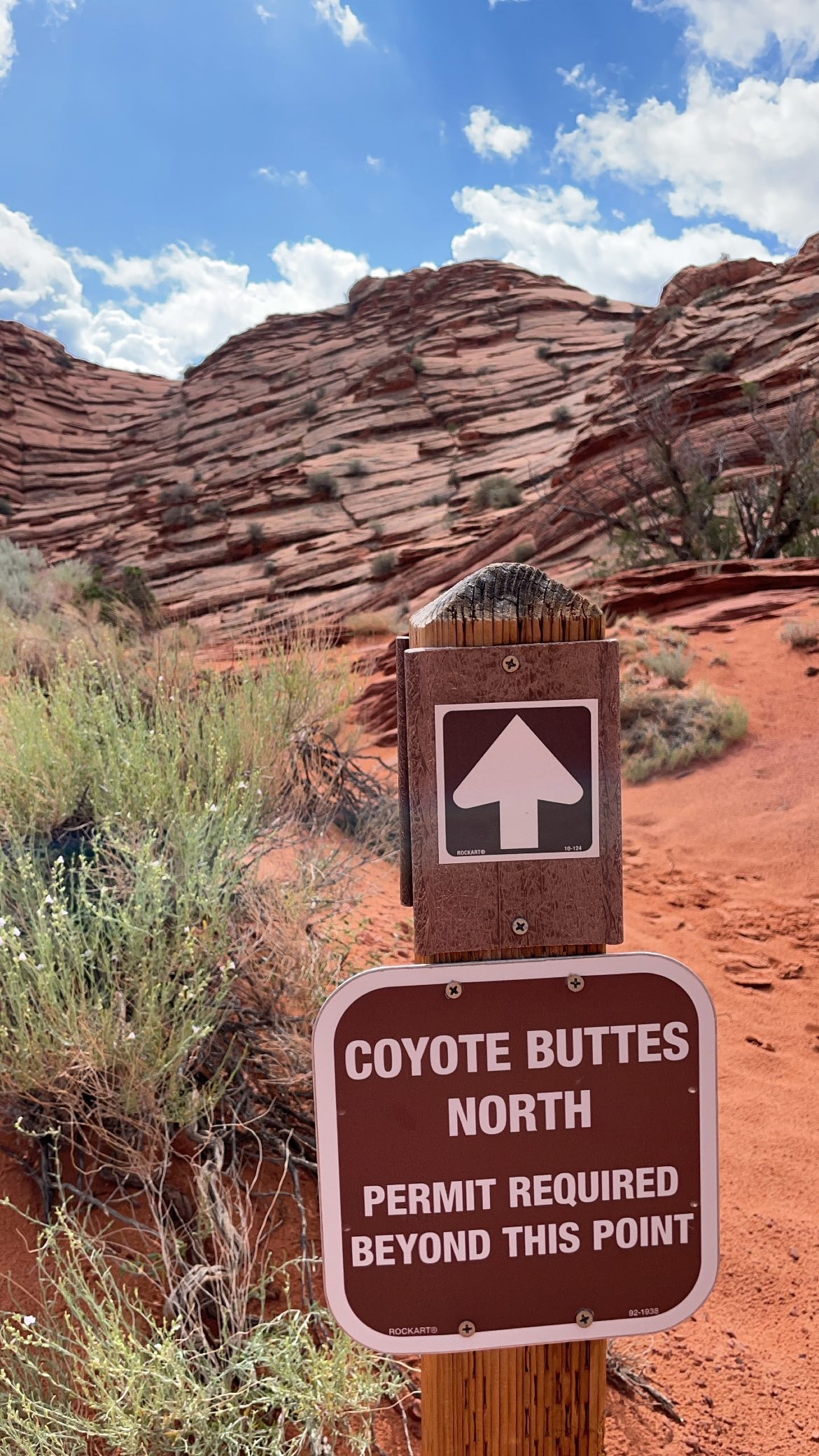
The Wave is located in the Coyote Buttes North section of the Paria Canyon-Vermillion Cliffs National Monument, which covers parts of Utah and Arizona. Because of the fragile nature of the site, only 64 people are allowed to visit each day (which seems like an infinitesimal amount but believe it or not they used to only allow fewer than 30 per day!). To manage access to the site, the Bureau of Land Management holds a lottery for permits. 48 permits are awarded via the online lottery 4 months in advance. The other 16 permits are awarded via a walk-up lottery in Kanab, Utah, the day before the permit’s effective date.
How hard is it then, realistically, to be chosen? Some are incredibly lucky and get a permit on their first attempt. Others, like me, enter the lottery pretty consistently and wait for years. Still others are, unfortunately, never chosen.
So, was I lucky? Did I get picked via the lottery?
Nope. I was lucky that I had a lucky and generous friend! She entered the lottery in April for a group of six to visit in August and was selected! She asked a group of friends if anyone wanted to join and I shouted OMG YES.
Our permits were secured, it was now time to prepare for the hike itself.
Getting to The Wave
First things first, we had to get to the trailhead.
The Wirepass trailhead for The Wave is along House Rock Valley Road.
There are two ways of approaching the trailhead: from the north on Highway 89 and from the south on Highway 89A. Both have their own joyful parts and it is highly recommended that you have a high-clearance four-wheel-drive vehicle. House Rock Valley Road is not maintained and has numerous washout points on both the northerly and southerly routes.
Generally speaking, the north approach to the trailhead is far shorter but cars will need to traverse the Buckskin Gulch Wash. If it has been raining, this wash can and will get deeper than you think and potentially carry away your vehicle. It had rained quite a bit the days leading up to our hike (August wraps up the monsoon season in the American southwest) so we decided to take the slightly more docile southern approach.
Approaching from the south was no slouch either. We had 3-4 river/stream crossings, some quite precarious. We had a 4WD Toyota 4Runner and an AWD Subaru. There were a few squirrelly bits but we took it slow, planned out our approaches, and made it through without too much difficulty.
Once we got to the trailhead, we signed the visitor’s registry, checked our water supplies (bring a LOT of water), and made our way to the trail to begin!
The surprisingly fierce hike to The Wave
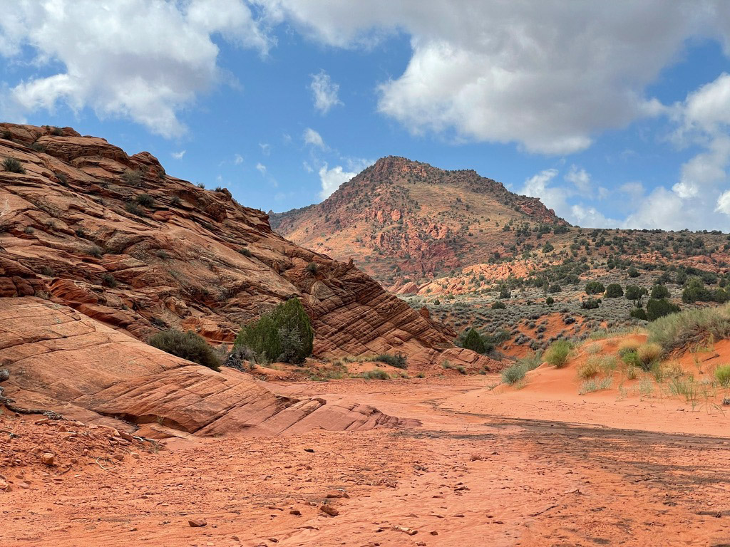
The Wave is in the middle of the most sparsely-populated area of the United States. The hike itself isn’t particularly long, only about 6.4 miles round trip from the trailhead. That’s not what makes it difficult, though. The Wave sits in the high desert. There is no water and no shade from the brutal summer sun.
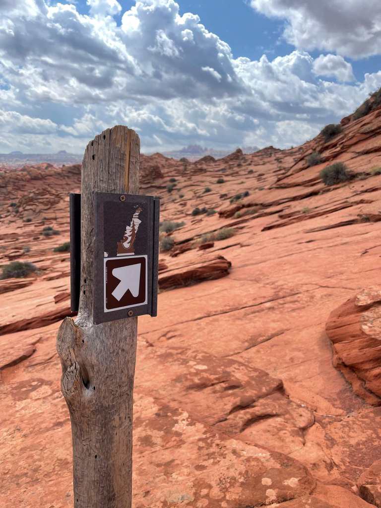
What feels like the most difficult part is that there really isn’t a trail at all. When you show up to pick up your permits the BLM office in Kanab, Utah, gives you a map with visual cues. To supplement the map, and to make my mom feel more comfortable, I picked up a GPS navigator thingy to ensure we were on the right track.
We made our way to the trail and followed the river wash, grateful for the surprisingly cool temperatures (we started at roughly 9:15am). We followed the wash around a few bends and reached the official Permit Area of the Coyote Buttes North.
We soldiered on, appreciating the scenery and taking it all in.
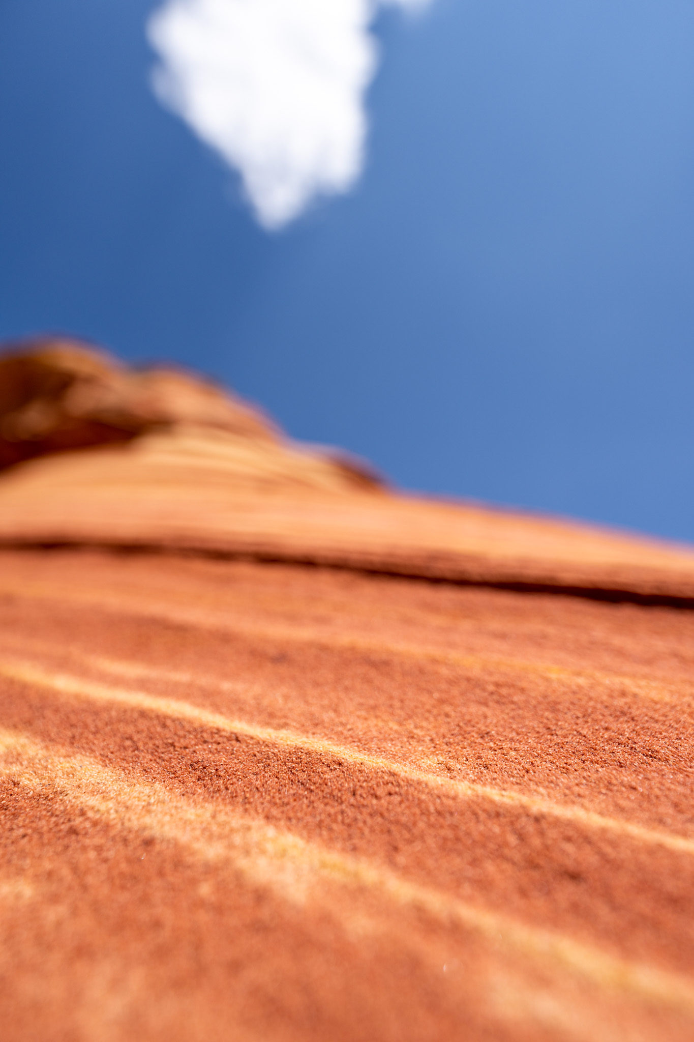
As we went along, we took frequent breaks to admire just how other-worldly everything looked. The sandstone told the history of the area.
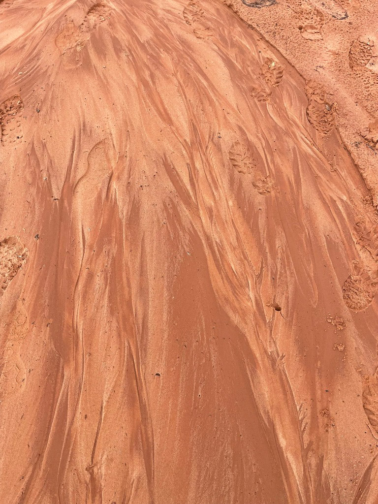
We were able to follow footsteps in the sand in front of us, checking our map and my navigation thingy, which we named Jim, to make sure we were on the right path.
After a river basin we scrambled up a sandstone incline and realized why the BLM map was so important.
The sand disappeared, along with the footprints. We were on our own. A solitary BLM guidepost showed us the general direction, but our maps and Jim would be the only way we would find The Wave among the 112,500 acres of the Vermillion Cliffs wilderness.
We trekked on, finding some lovely water pools left by the rain, which made for some great reflection shots.
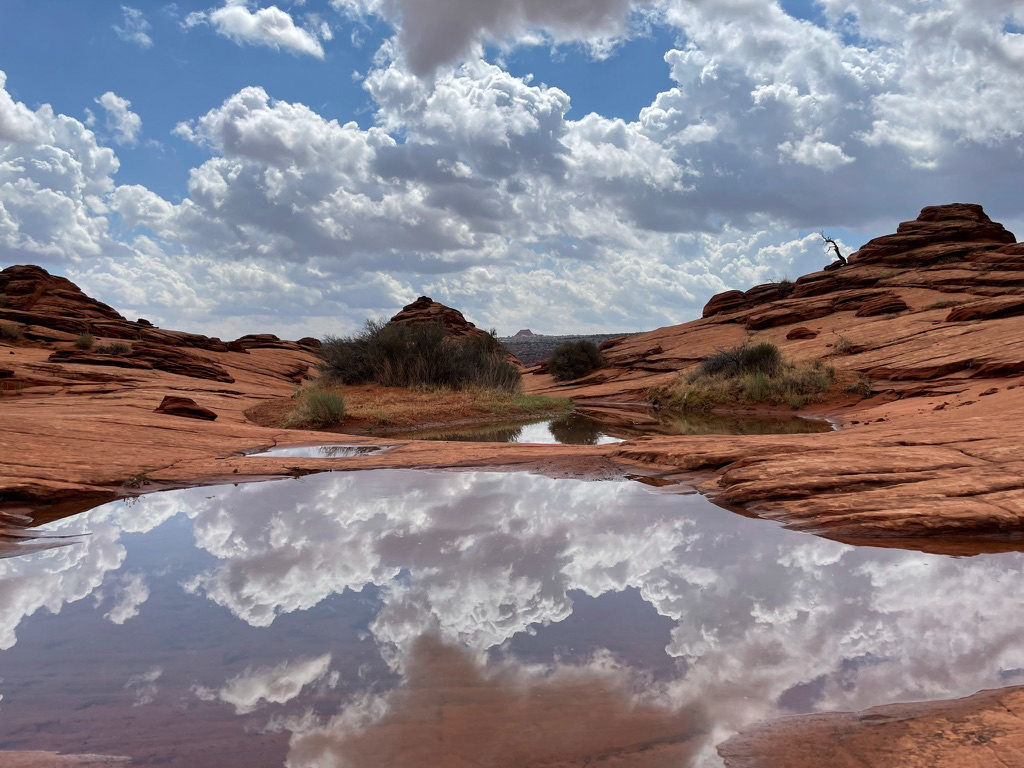
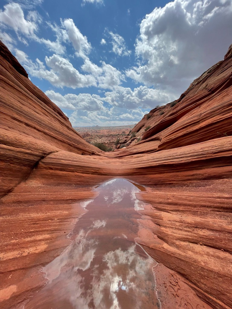
We crossed the border into Arizona (I only knew this because of Jim) and we were nearly there. We crossed another river basin, stopping to admire the textures in the sand in the basin.
There was one last scramble up to The Wave. This was the hardest part of the hike by far, it was steep and there was soft sand all over the place, making it hard to find solid footing. On our way up I strategically took a video to make it look like I was overwhelmed with the topography but really just masking that I needed a break.
At long last, it was time. We came over the crest of a small hill and entered a different world.
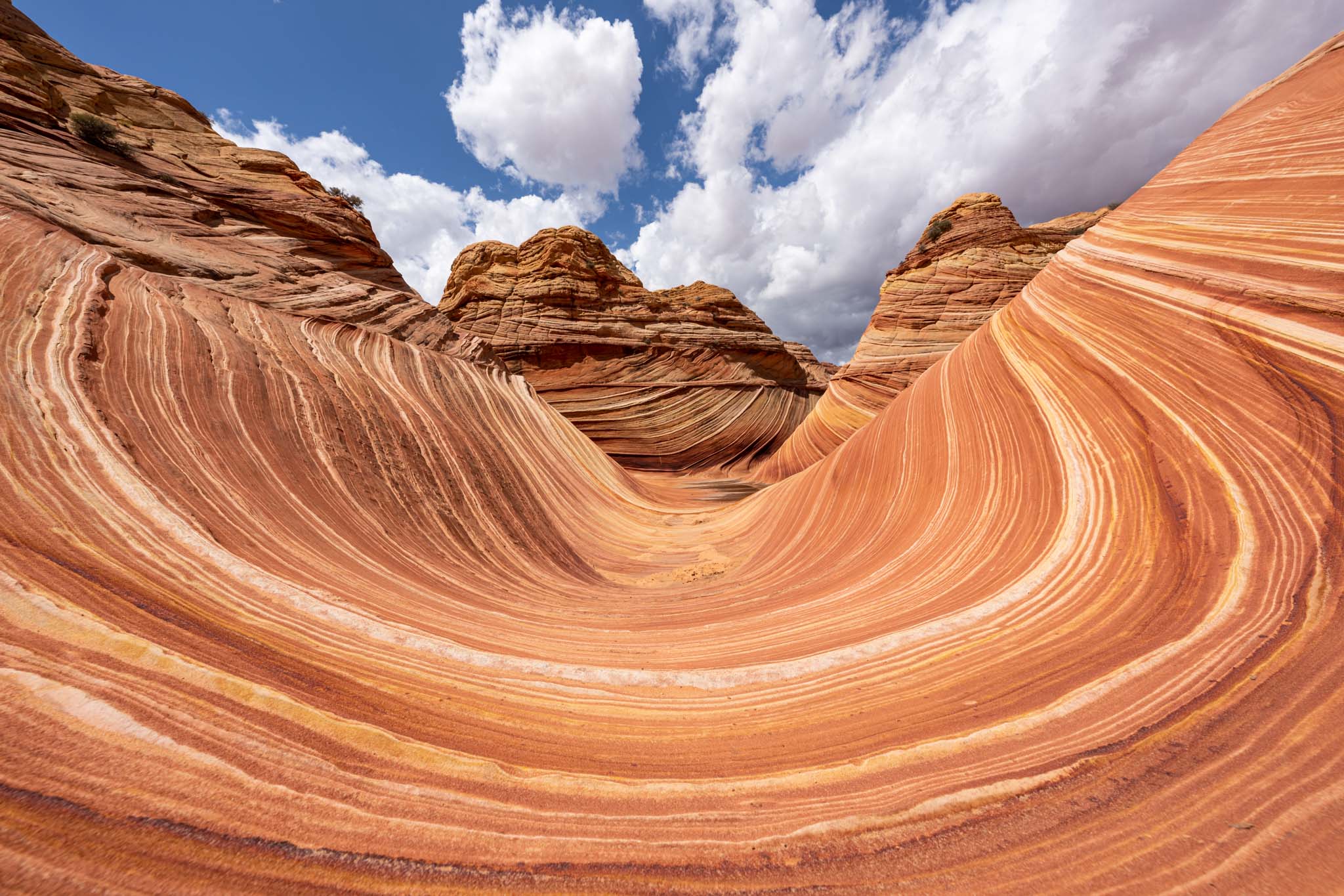
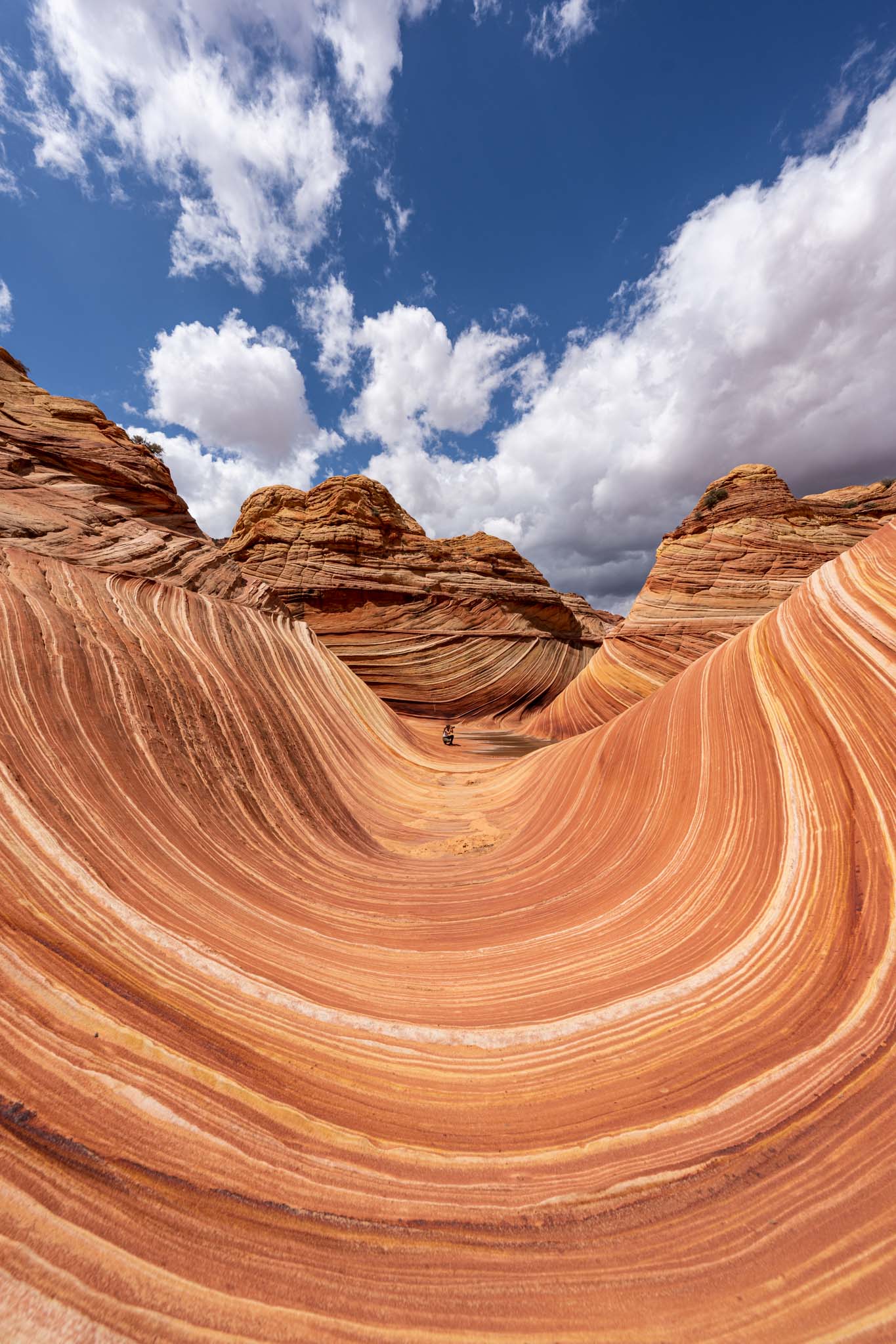
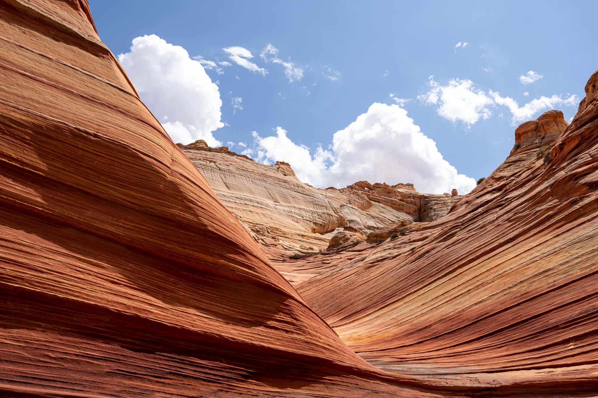
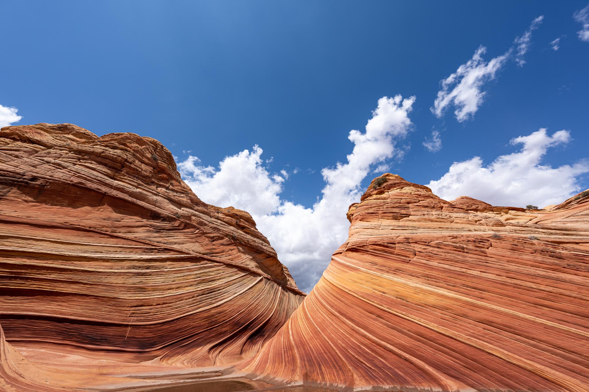
The Wave
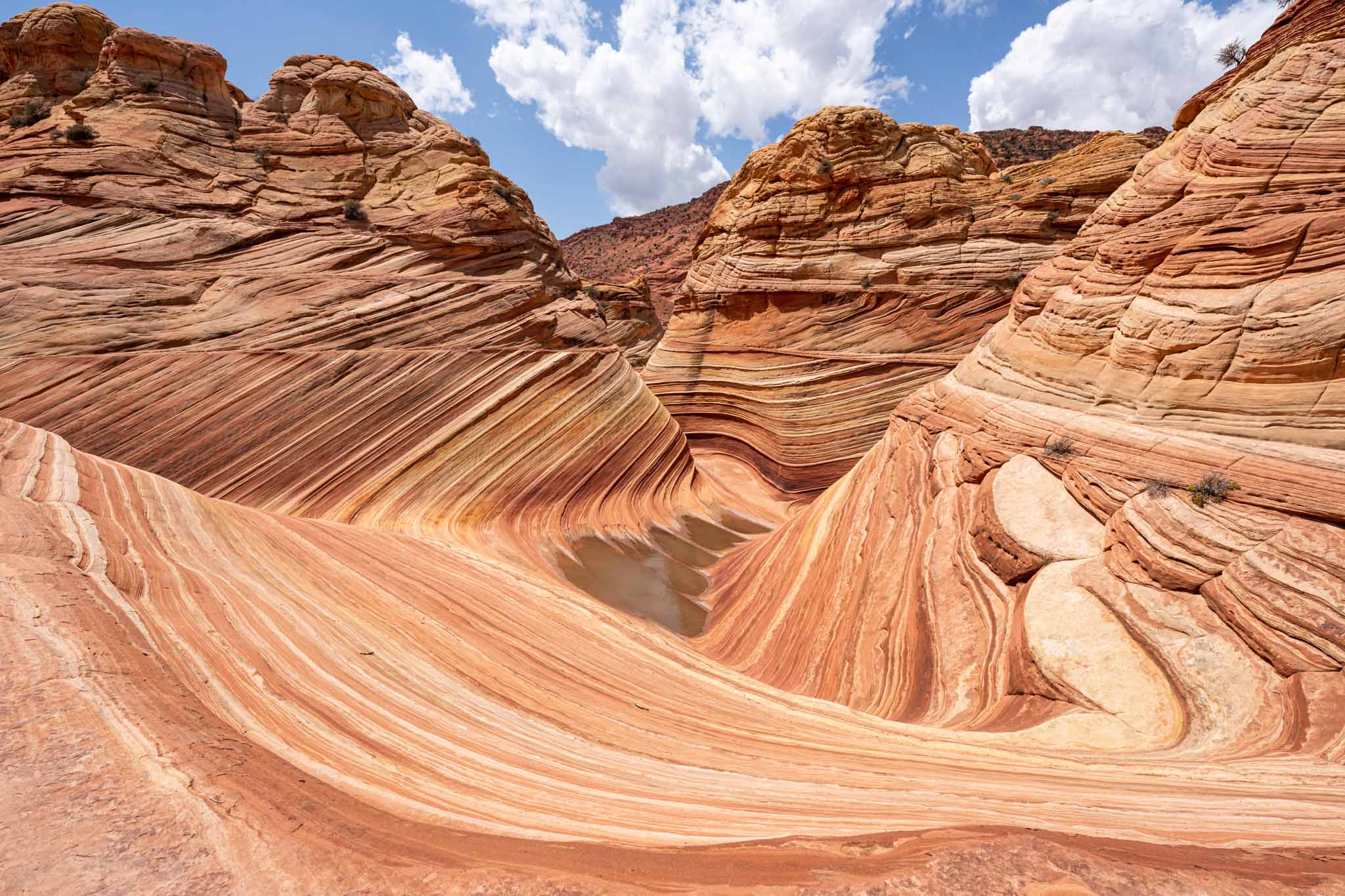
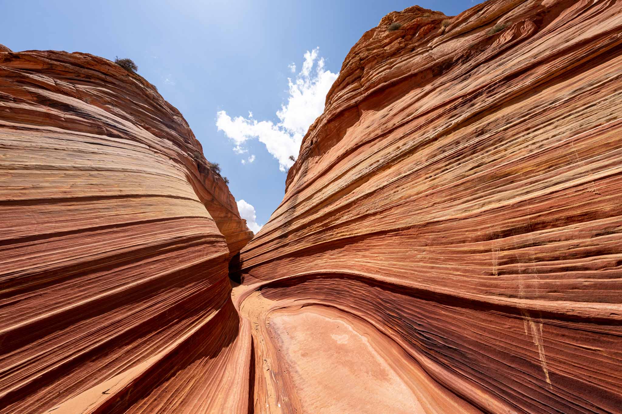
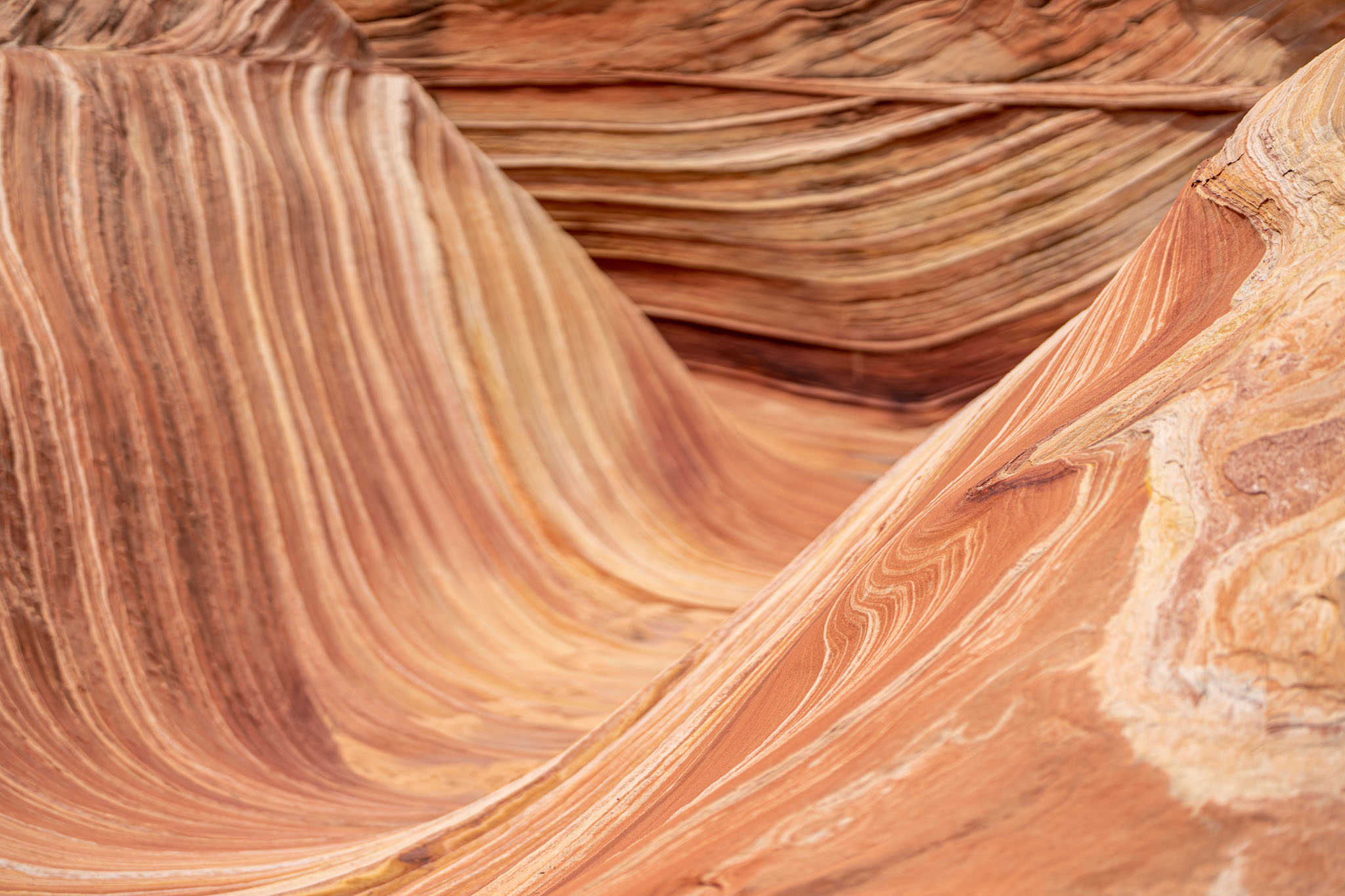
It was unlike anything I had ever seen in my life. The textures, the lines, everything. I waited five years to see this view in person and it was worth all of it.
First things first: I sat there and took it all in before I took my camera out. And yes, I had a bit of a cry. It was so beautiful.
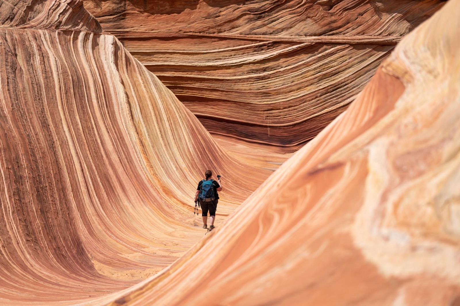
Then it was time to take some pictures. I had read that The Wave was actually quite small, and I guess those who said it were right, but the heights of the hills caught me by surprise. I could have spent all day out there finding different compositions.
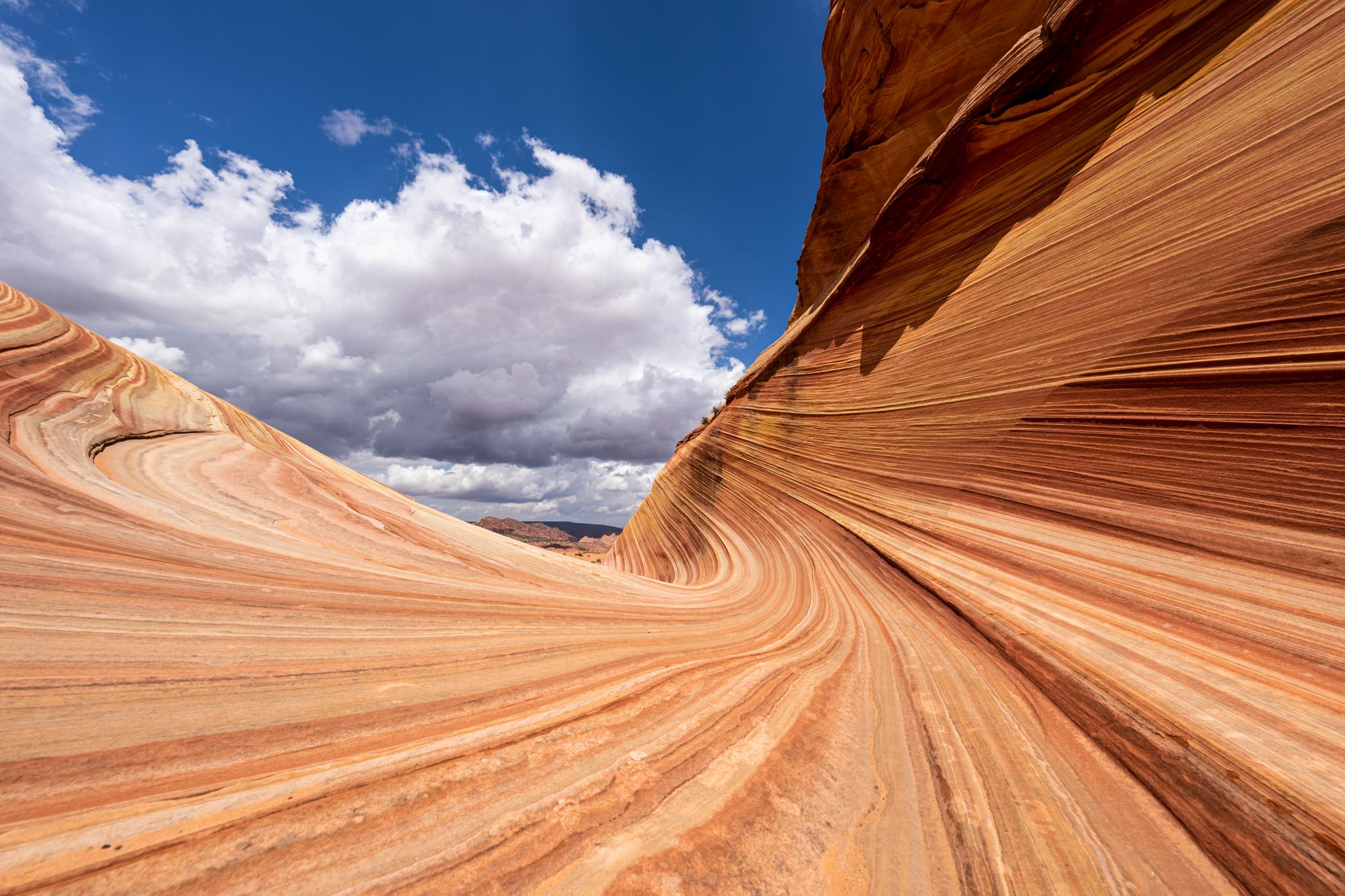
If you want the dramatic wavy pictures like above you’ll need to have an ultra-wide-angle lens. I was using my Sony A1 camera and mostly the 12-24 f2.8 GM lens. I switched to the new 50mm f1.2 GM lens for a couple of shots but changing lenses was a bit of an adventure with all of the sand blowing around.
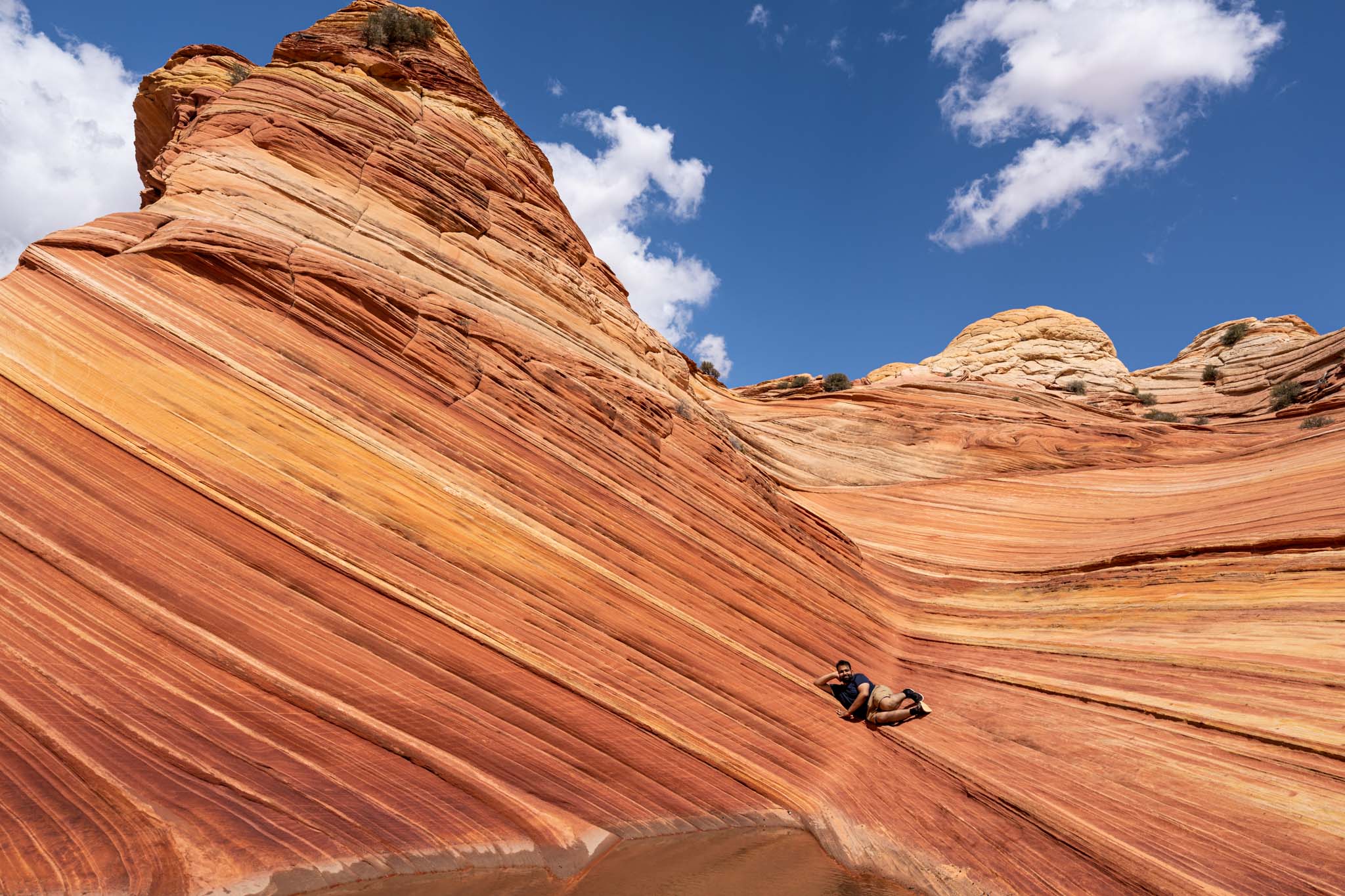
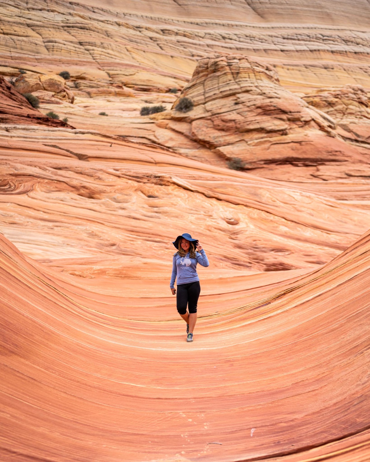
I asked my buddy to nestle seductively in the crease of a part of The Wave to give you an idea of the scale.
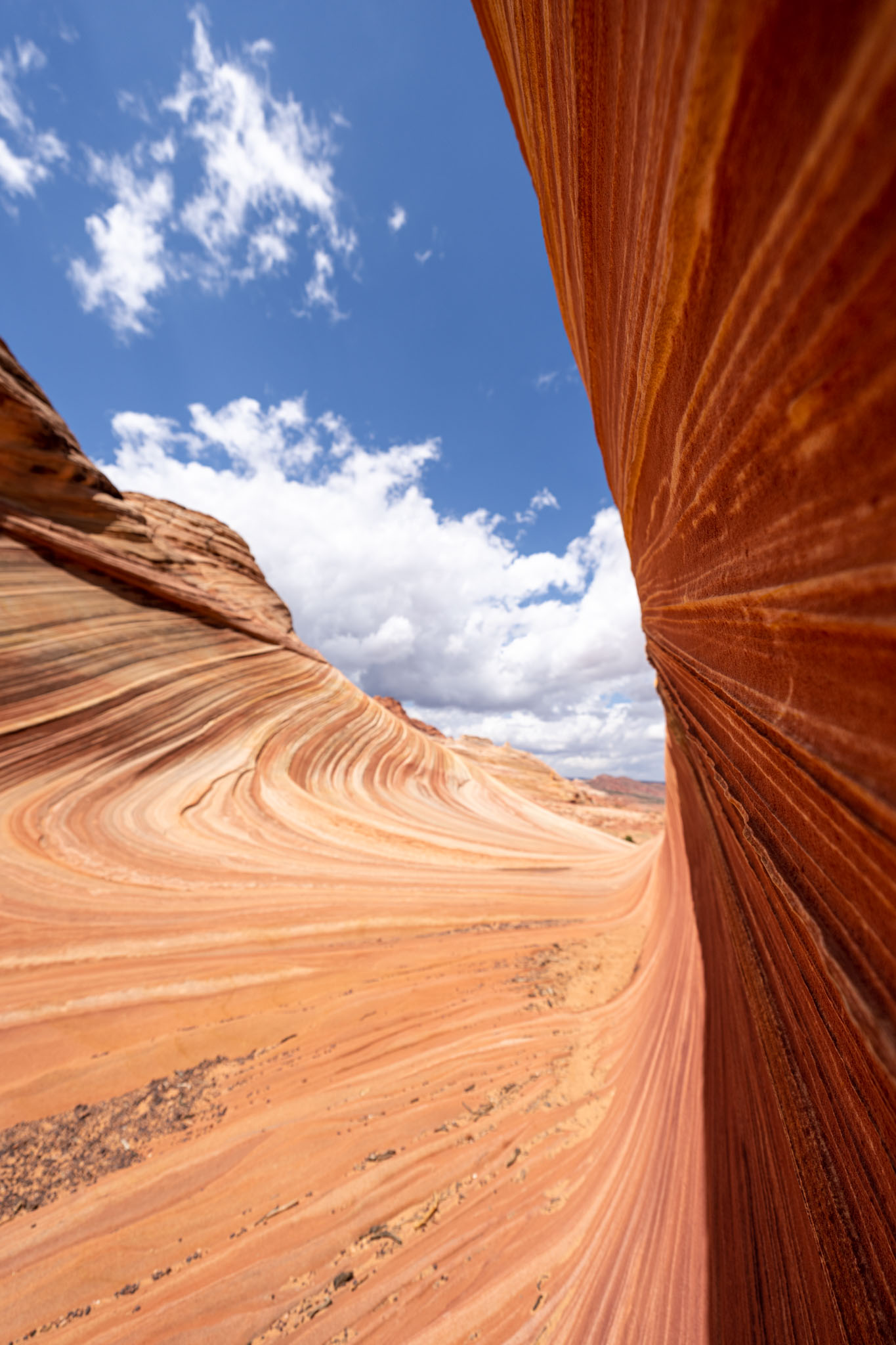
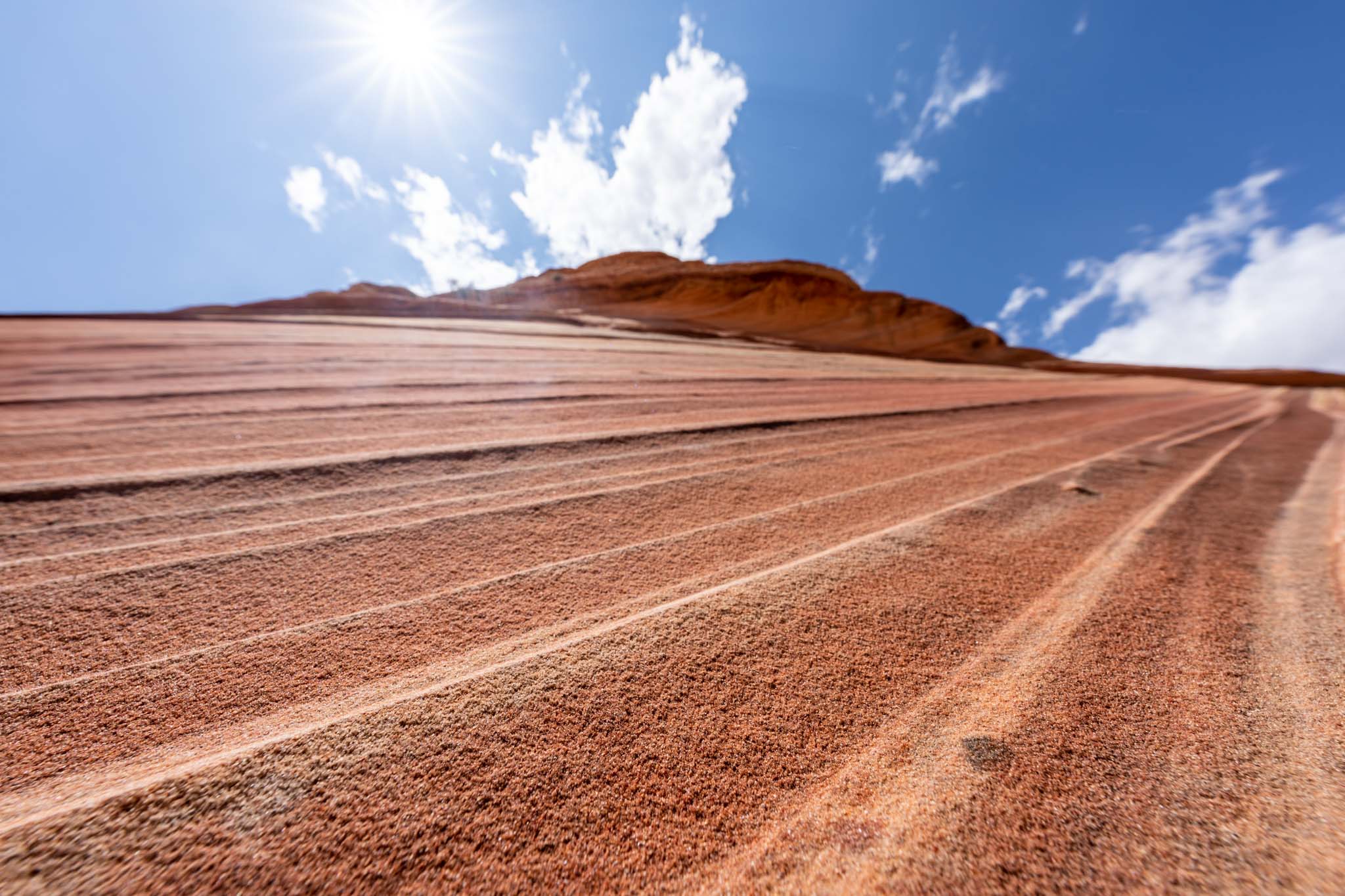
I kept walking around the site, finding more details to capture. I was most surprised by the textures of each “wave”, the lines were crests of sandstone. It wasn’t nearly as smooth as I thought.
Another photographer friend of mine was walking around the site taking some pictures and I caught her right in the middle of The Wave, I really loved this one.
Another friend was shooting some video for her YouTube channel so I got a quick one of her.
I found even more textures to capture, looking at the site from every direction.
Another friend of mine LOVES hats and brought a nice one to wear at The Wave so I got a shot of her too.
We wrapped up our time at The Wave and I wanted one last shot, looking out from The Wave. The small crests of the wavelets created some beautiful leading lines with the hills of Utah in the background. It really captured the exaggerated nature of the landscape and summed up the scene for me.
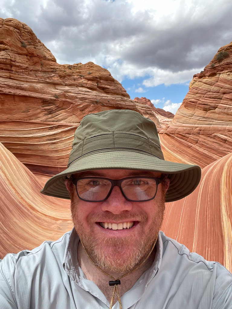
Oh, and I took a selfie of some dude’s face blocking The Wave.
The hike back
Soooo the sun came out. It got hot. I didn’t really take many pictures on the way back because, well, it got hot.
We followed the dutiful directions provided by Jim (the navigation thingy) and made our way back to the trailhead. I carried two 16oz bottles of electrolyte fluid and two 32oz Nalgene bottles of water and that was plenty for me (it would’ve been different had it been hot the entire time though). Our cars were in the parking lot waiting for us and we went out the north way to Highway 89. The Buckskin Gulch Wash still had some flowing water in it but a lot of the water had baked off so we were able to pass through it with little issue.
After The Wave
We arrived back at Kanab a little hangry and ready for some food. Over burgers and fries we recounted epic tales of victory over the harsh desert climate and shared some of our photos.
Could I have done The Wave by myself? Sure. But it was so much fun hiking to it with five friends. The area around The Wave was beautiful and gorgeous and I wish I would’ve taken more pictures. Just means I’ll have to go back, I guess (and I would in a heartbeat). Hopefully next time it won’t take five years!
(oh, and we might have gone to High West Distillery in Park City the next day to sample some great whiskies!)

Have you been to The Wave? How was your experience? Tell me in the comments below!

Very cool never heard of it but adding to bucket list.
So lucky, I went there twice for in-person lottery and multiple times online still no luck 🙁
Great recap, Andy! I have a couple of questions…Does your permit allow you to be there at any point on that day, or do you have a specific time slot? Did you see any other groups/people while you were out there?
Hi Kate! The permit allows you to be there for a 24-hour period, there’s no overnight camping allowed but I have friends who left the trailhead at 12:30am to do astrophotography out there. We saw another group of 3 people and that was it!
Well aware of the Wave, but at 82 not sure I’m game, even if you provided a permit. Be great to get a Winter ticket.
We were there the first week of May. All the good stuff but the temps were in the 70’s max. Much more pleasant hike out but still surprisingly warm on the exposed sandstone. Took 2 tries on the lottery
I enjoy reading about your experience at The Wave, I would like to visit one day. The web site says that you need a permit to camp overnight, do you need one for a day hike?
Mark
Yes, you need a permit no matter what.